With support from the Department of Homeland Security Science & Technology Directorate (DHS S&T) and the Federal Emergency Management Agency (FEMA) National Earthquake Hazards Reduction Program (NEHRP), CUSEC has developed a series of templates for information sharing and field reporting. These templates are built on the ArcGIS Online platform which is widely used among emergency management practitioners.
The templates highlighted below are provided through the CUSEC Regional Information Sharing Platform (RISP), a regional information sharing hub for CUSEC Member States and partners to share data, web applications and other resources.
Use the links provided for each template to find out more, test drive the applications, or transition them to your own organization.

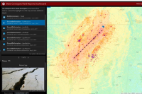
CUSEC RVS App

CUSEC Safety Evaluation App
The CUSEC Safety Evaluation App is a mobile data collection tool for performing post-disaster safety evaluations of buildings (i.e. ATC-20 or 45). Local and State governments can use the tool to record structural damage and provide situational awareness.
CUSEC State Geologist Field Reporting Template
The CUSEC State Geologist Field Reporting template providesa post-disaster reporting process for state geologists, and enables data collected to be seamlessly shared to state emergency operation centers, federal partners, and neighboring states.
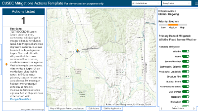
CUSEC Mitigation Action Tracking Template
The CUSEC Mitigation Action Tracking template is an easy-to-use tool for emergency managers to track mitigation actions and mitigation pre-applications for state hazard mitigation grant programs. Planning teams may use the dashboard for education, training, and plan maintenance.

Community Lifeline Reporting Template
The Community Lifeline Reporting template provides state and local agencies a lightweight, easy-to-use capability to track and share the status of FEMA’s seven Community Lifelines.

CUSEC Critical Infrastructure Template
The CUSEC Critical Infrastructure template provides a model for states to align their Critical Infrastructure and Key Resources (CIKR) data to FEMA’s seven Community Lifelines and CISA’s 16 critical infrastructure sectors to help monitor infrastructure status across a state, develop CIKR status reports, and to prioritize infrastructure to support response, recovery, and mitigation efforts.

CUSEC PPE Tracking Template
The CUSEC Personal Protective Equipment (PPE) Tracking template provides PPE tracking status and visualization for hospitals and other medical centers using Esri’s Survey123 form and Dashboard. It can be used to assess available PPE inventory, burn-rate, and forecasted shortfall for various emergency response scenarios, and can be customized depending on the user’s needs.