If you recently felt an earthquake, you can report your experience through the USGS and their Community Internet Intensity reporting program, referred to as “Did You Feel It?” (DYFI). DYFI collects information from individuals who felt an earthquake and creates maps that show extent of damages, shaking intensity, etc.
By using the DYFI system, the public informs scientists on ground motion behavior that helps validate past research and theory relating to earthquakes. This is especially important in the central U.S. where geology is much different than in other areas of the country such as California or Alaska.
For users of the radio system known as Winlink, there are options to submit DYFI reports using radio frequencies. Click here to learn more about submitting DFYI reports using Winlink.
Click here to visit the Did You Feel It? reporting site.
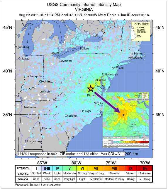 On August 23, 2011 a M5.8 earthquake occurred near Louisa County in central Virginia . The earthquake was felt by tens of millions of people in the eastern U.S. and as far away as Canada.
Losses from the earthquake included several schools and more than 600 homes in Virginia, as well as significant damage to the National Cathedral, Smithsonian, and Washington Monument 90 miles away in Washington, D.C.
Following the earthquake, nearly 150,000 people used the USGS “Did You Feel It?” system to report damages and what they felt during the shaking. At the time, it was the most widely felt and reported earthquake in U.S. history.